Use the varied possibilities for obtaining information, including directly on your smart phone.
To facilitate this, some of our partners offer appropriate apps, most of them free.
Use the varied possibilities for obtaining information, including directly on your smart phone.
To facilitate this, some of our partners offer appropriate apps, most of them free.
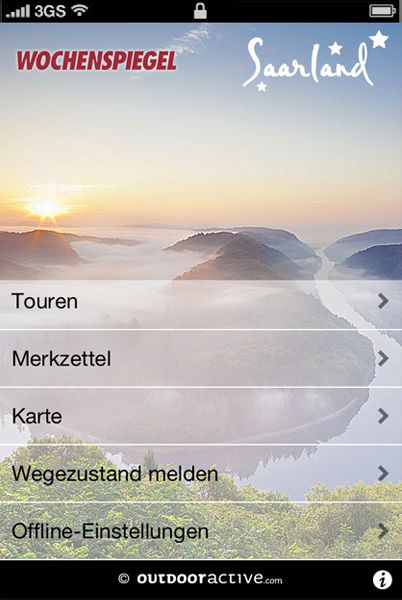
A detailed app for hiking on premium trails in all of Saarland, including those segments of the Saar-Hunsrück Climb. All tours have detailed information: key facts (length, meter elevation, duration, difficulty), detailed description, including images, tour route on the map, elevation profile, restaurant recommendations as well as sights. Available in German, English, French, Italian, and Slovenian.


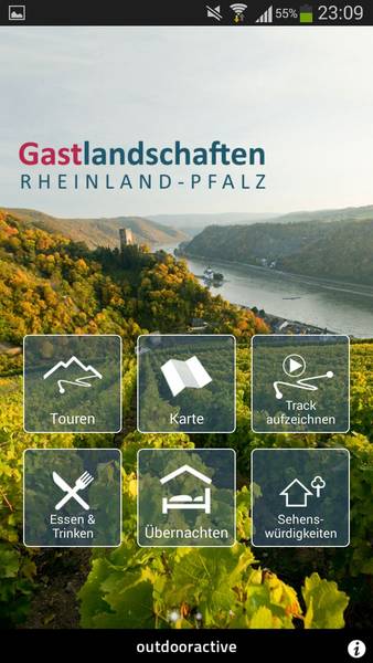
Hiking and cycling in the Eifel and Hunsrück mountains, in the Westerwald, Rhine-Hesse, and Palatinate regions, on the Rhine, Moselle, Nahe, Lahn, and Ahr rivers. You can experience nature and culture on selectred hiking tours and cycling trails - with tour descriptions, photos, and elevation profiles for long-distance trails, short tours, and theme trails - also suitable for cycling trails, moutain bike tours, and racing bike routes. All tours and the map can be saved offline on your PC or laptop at home, so that you need no cellular/mobile network on the tour.
The German Railroad (DB) Navigator informs you about all connections, and you can even book your ticket directly through the app.
The on-time informs you before and during the journey about the current status.


